1899 Norwalk Connecticut Bird's Eye View Map and 50 similar items


Free Shipping
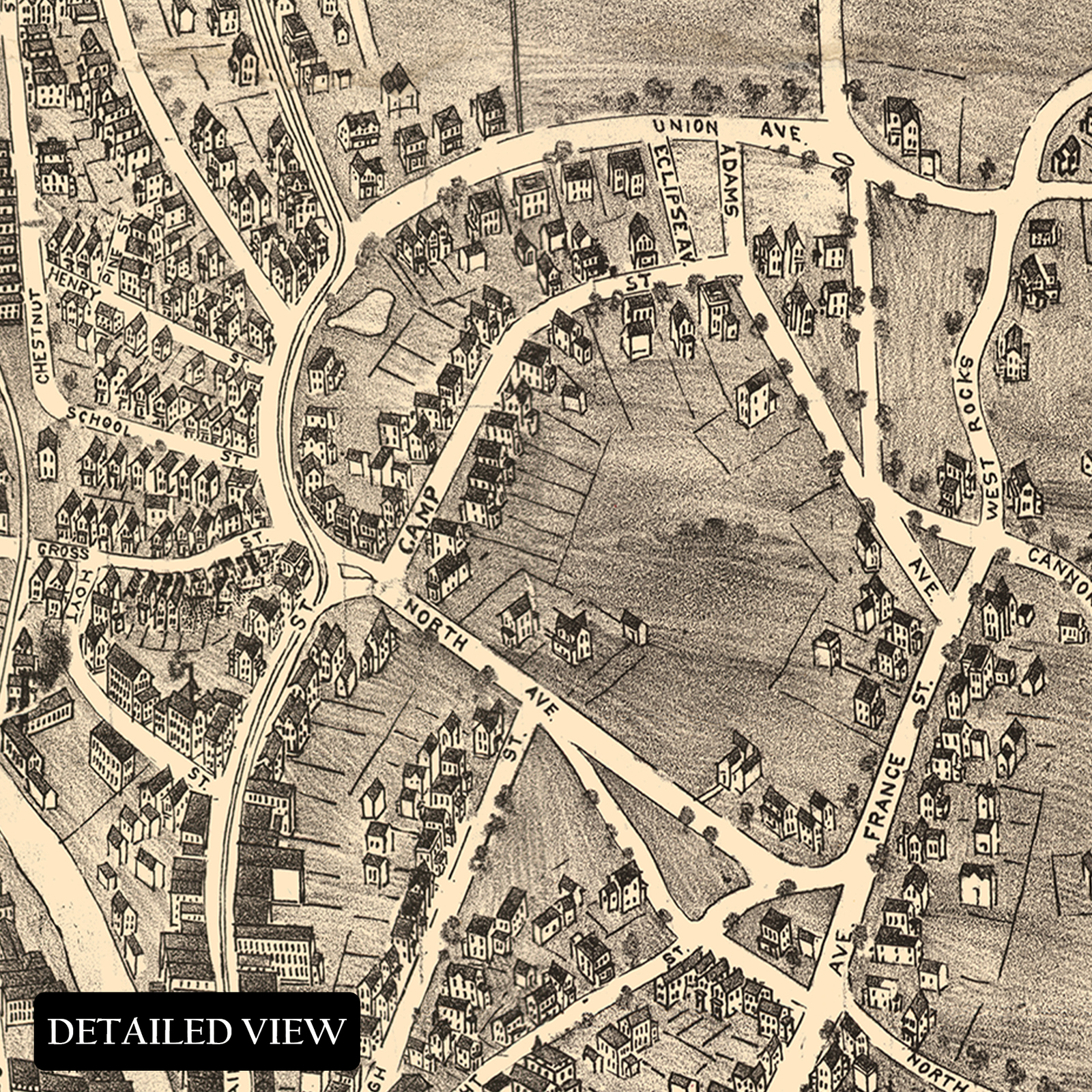
1899 Norwalk Connecticut Bird's Eye View Map Poster Wall Art Print
$59.99 - $89.99
View full item details »

Shipping options
Seller handling time is 1 business day Details
FREE in United States
Return policy
Full refund available for DOAs
Details
Purchase protection
Payment options
PayPal accepted
PayPal Credit accepted
Venmo accepted
PayPal, MasterCard, Visa, Discover, and American Express accepted
Maestro accepted
Amazon Pay accepted
Nuvei accepted
View full item details »
Shipping options
Seller handling time is 1 business day Details
FREE in United States
Return policy
Full refund available for DOAs
Details
Purchase protection
Payment options
PayPal accepted
PayPal Credit accepted
Venmo accepted
PayPal, MasterCard, Visa, Discover, and American Express accepted
Maestro accepted
Amazon Pay accepted
Nuvei accepted
Item traits
| Category: | |
|---|---|
| Quantity Available: |
16 in stock |
| Condition: |
New |
| Type: |
|
| Sizes: |
Listing details
| Seller policies: | |
|---|---|
| Shipping discount: |
Seller pays shipping for this item. |
| Posted for sale: |
April 13 |
| Item number: |
1738799446 |
Item description
Feature Points
VINTAGE MAP REPRODUCTION: You?ll love this high quality historic reproduction of 1899 Norwalk Connecticut Map Art Poster. Our museum quality prints are archival grade, which means it will look great and last without fading for over 100 years. Our print to order maps are made in the USA and each map is inspected for quality. This beautiful artwork is a perfect addition to your themed decor. Vintage maps look great in the home, study or office. They make a perfect gift as well.
MUSEUM QUALITY: This high quality map print will be a great addition to your vintage-themed wall. Don't waste money on cheap-looking, thin paper posters. We use thick, fine art print quality matte paper. Our professional?s choice matte paper displays artwork in high detail without glare. The color is vibrant and text is easy to read. When framed, this map looks absolutely stunning.
A LOOK BACK AT HISTORY: This is an impressive, historic reproduction of 1899 Norwalk Wall Map of Connecticut. A true piece of history. See our product description section for more fascinating information about this historic map and its significance.
READY TO FRAME: This print includes a 0.2 inch border for a perfect frame fit and look. Our maps are designed to fit easy-to-find standard frame sizes, saving you money from having to pay for a custom frame. Each map is inspected for quality and shipped in a rigid tube.
HISTORIX: We love history and art. Sometimes old maps have tears, folds, separations and other blemishes. We digitally restore and enhance maps while keeping its historical character. All our maps are proudly made in the USA. Customers all over the world love our vintage maps and we know you will too.
Additional Information
Located in both the Bridgeport and New York City metropolitan area and on the banks of the Long Island Sound, Norwalk, Connecticut has a rich history and distinctive culture and was originally settled in 1649. By the time of this publication, the region had grown considerably and developed a distinct culture shaped by its location and the influx of Eastern and Western European immigrants who established neighborhoods and communities in the city based on cultural lines, many of which exist to this day. Norwalk's economy was largely tied to commercial fishing and oyster cultivation, and the first steam-powered oyster dredging ship sailed out of Norwalk Harbor in 1874.
As the United States approached the turn of the nineteenth century, the nation had experienced a significant period of prosperity during the so-called Gilded Age. The region played a pivotal role during the American Revolution as British Warships occupied Long Island Sound in an attempt to thwart the Continental Navy. The Battle of Norwalk was a series of skirmishes between the Continental Army and British forces who conducted raids along the Connecticut coast, which are also collectively known as Lord Tyron's Raid.
Bird's eye perspectives were widely popular during the nineteenth century and featured prominent civic buildings and other economic attractions to entice residents and merchants alike. Landis Hughes were New York City-based cartographers who were known for their classical style and distinctive aesthetic. This panoramic map is truly a piece of cartographical history that transports the viewer back in time.


 - $12.00")


 - $15.00")


-
Refine your browsing experience
We can show you more items that are exactly like the original item, or we can show you items that are similar in spirit. By default we show you a mix.


 *Francine De... - $75.00")

 - $18.00")


 Edition Lithograph on Paper- Las... - $1,555.00")


This item has been added to your cart
 1899 Norwalk Connecticut Bird's Eye View Map Poster Wall Art Print added to cart.
16 available in stock
1899 Norwalk Connecticut Bird's Eye View Map Poster Wall Art Print added to cart.
16 available in stock
View Cart or continue shopping.
 Please wait while we finish adding this item to your cart.
Get an item reminder
We'll email you a link to your item now and follow up with a single reminder (if you'd like one). That's it! No spam, no hassle.
Already have an account?
Log in and add this item to your wish list.