HISTORIX Vintage 1906 Map of Casco Bay and similar items


Free Shipping
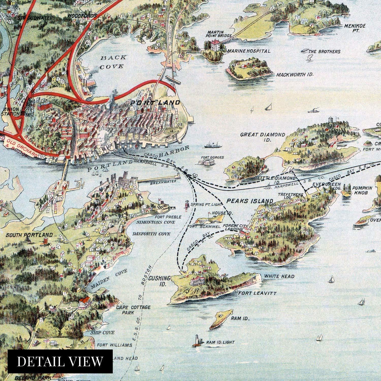
HISTORIX Vintage 1906 Map of Casco Bay Portland Maine - 16x24 Inch Portland Main
$39.99 - $59.99
View full item details »

Shipping options
Seller handling time is 1 business day Details
FREE via to United States
Return policy
Full refund available for DOAs
Details
Purchase protection
Payment options
PayPal accepted
PayPal Credit accepted
Venmo accepted
PayPal, MasterCard, Visa, Discover, and American Express accepted
Maestro accepted
Amazon Pay accepted
Nuvei accepted
View full item details »
Shipping options
Seller handling time is 1 business day Details
FREE via to United States
Return policy
Full refund available for DOAs
Details
Purchase protection
Payment options
PayPal accepted
PayPal Credit accepted
Venmo accepted
PayPal, MasterCard, Visa, Discover, and American Express accepted
Maestro accepted
Amazon Pay accepted
Nuvei accepted
Item traits
| Category: | |
|---|---|
| Quantity Available: |
16 in stock |
| Condition: |
New |
| ASIN: |
B0885QBPTL |
| Item Name: |
HISTORIX 1906 Map Birds Eye View of Casco Bay, Portland, Maine |
| manufacturer: |
Historix |
| Item Type Keyword: |
prints |
| Brand: |
HISTORIX |
| Unspsc Code: |
52140000 |
| sizes: |
Listing details
| Seller policies: | |
|---|---|
| Shipping discount: |
Seller pays shipping for this item. |
| Posted for sale: |
April 23 |
| Item number: |
1741850303 |
Item description
With an official 136 islands in the Casco Bay, it figured prominently in the War of 1812, serving as an anchorage for US Naval ships. The waters that are surrounded by Portland, Maine have long served as the primary economic driver for the city, and commercial fishing is an essential industry.
Produced by George H. Walker’s lithography company in 1906, this stunning depiction shows the railroads and steamship lines that were so important to the region. Walker’s grandson and great-grandson would later both become President of the United States. The peninsula was originally settled in 1632 as a fishing and trading village. By the turn of the 20th century, the region was well known for its sailing and sport fishing.
By 1911 five railroads used the city as a hub, and it remains the largest city in Maine. These hubs were essential for the region, and goods flowed into the Northeast and Canada. The nearby town of Deering was annexed by Portland in 1899 and greatly expanded the area for development away from the shoreline.
The Grand Trunk Railroad was completed in 1852 and served as the primary source for imports to Montreal, especially crucial in the winter months when the city became inaccessible by water. This trade route was an important income source for residents of Portland, and the Portland Rail Company produced more than 600 locomotives. This stunning depiction shows the city in a time of great prosperity and is truly an authentic piece of cartographical history.
Our museum quality giclee print comes printed with archival ink on premium heavyweight matte paper. Shipped in a sturdy cardboard tube your print will arrive ready to be framed. This eye-catching vintage map reproduction print makes the perfect gift for anyone that loves history and imagery.
Loading
This item has been added to your cart
 HISTORIX Vintage 1906 Map of Casco Bay Portland Maine - 16x24 Inch Portland Main added to cart.
16 available in stock
HISTORIX Vintage 1906 Map of Casco Bay Portland Maine - 16x24 Inch Portland Main added to cart.
16 available in stock
View Cart or continue shopping.
 Please wait while we finish adding this item to your cart.
Get an item reminder
We'll email you a link to your item now and follow up with a single reminder (if you'd like one). That's it! No spam, no hassle.
Already have an account?
Log in and add this item to your wish list.