HISTORIX Vintage 1865 South Carolina Map and 50 similar items


Free Shipping
HISTORIX Vintage 1865 South Carolina Map Canvas - 18x24x1.5 Inch Canvas Wrap Vin
$253.99 - $276.99
View full item details »

Shipping options
Seller handling time is 1 business day Details
FREE via to United States
Return policy
Full refund available for DOAs
Details
Purchase protection
Payment options
PayPal accepted
PayPal Credit accepted
Venmo accepted
PayPal, MasterCard, Visa, Discover, and American Express accepted
Maestro accepted
Amazon Pay accepted
Nuvei accepted
View full item details »
Shipping options
Seller handling time is 1 business day Details
FREE via to United States
Return policy
Full refund available for DOAs
Details
Purchase protection
Payment options
PayPal accepted
PayPal Credit accepted
Venmo accepted
PayPal, MasterCard, Visa, Discover, and American Express accepted
Maestro accepted
Amazon Pay accepted
Nuvei accepted
Item traits
| Category: | |
|---|---|
| Quantity Available: |
16 in stock |
| Condition: |
New |
| ASIN: |
B09BG228WZ |
| Item Name: |
1865 Colton's South Carolina |
| Item Type Keyword: |
artwork |
| Product Site Launch Date: |
2021-07-29T15:14:00.786Z |
| Unspsc Code: |
44103112 |
| sizes: |
Listing details
| Seller policies: | |
|---|---|
| Shipping discount: |
Seller pays shipping for this item. |
| Posted for sale: |
April 15 |
| Item number: |
1739667881 |
Item description
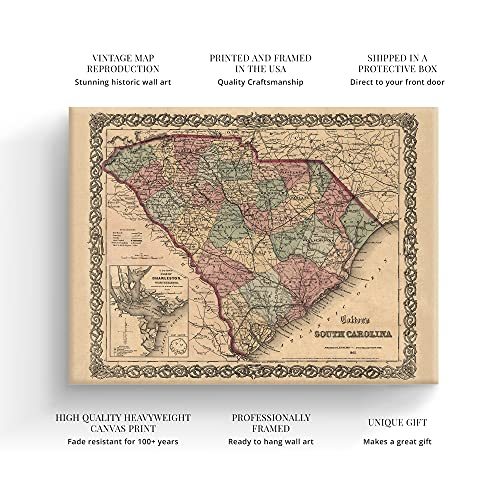
Based on depictions of the region from the decade prior, this map was published in 1865 at the close of the American Civil War and produced by prominent American cartographer and publisher J.H. Colton. Colton employed a more costly steel engraving method that was then colored by hand, and his maps were known for their premium quality, extensive detailing, and distinctive aesthetic. This map also features the signature border that Colton maps were known for.
The decision to depict the city of Charleston and also Fort Sumter, given the period, is unique given the former’s role at the start of the Civil War. Charleston’s history is deep, and the city had been experiencing great prosperity during the antebellum due to its bustling ports. Charleston was a key fortification point for the Confederacy, and it did not fall to Union Forces until the very last months of the Civil War.
This handsome depiction of the state shows it in a time of great transition, and these maps were often produced for markets in Western Europe. Europeans had become fascinated with the results of the American Civil War. They were eager to display locations that had historical significance, and South Carolina was easily one of the most symbolic.
This is truly an authentic piece of cartographical history, and the extensive details in Colton’s publication allow historians to gain greater insight into the daily lives of prominent South Carolinians and how their lives had been altered in the period stretching from antebellum to reconstruction.
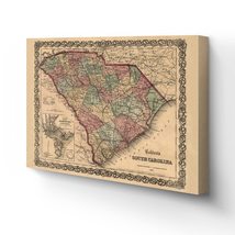
Our ready-to-hang canvas wall art prints are made in the USA using the highest quality materials with professional craftsmanship. This beautiful artwork is a perfect addition to your themed decor. Historic prints look great in the home, study or office. They also make an unforgettable gift.
|
Why are we showing these items?
Booth
Historic Prints |

|


-
Refine your browsing experience
We can show you more items that are exactly like the original item, or we can show you items that are similar in spirit. By default we show you a mix.


This item has been added to your cart
 HISTORIX Vintage 1865 South Carolina Map Canvas - 18x24x1.5 Inch Canvas Wrap Vin added to cart.
16 available in stock
HISTORIX Vintage 1865 South Carolina Map Canvas - 18x24x1.5 Inch Canvas Wrap Vin added to cart.
16 available in stock
View Cart or continue shopping.
 Please wait while we finish adding this item to your cart.
Get an item reminder
We'll email you a link to your item now and follow up with a single reminder (if you'd like one). That's it! No spam, no hassle.
Already have an account?
Log in and add this item to your wish list.