Proseries Wall Map: Western United States (R) and 46 similar items
Free Shipping
PROSERIES WALL MAP: WESTERN UNITED STATES (R)
$266.31
View full item details »

Shipping options
Estimated to arrive by Mon, Jun 30th.
Details
FREE via UPS Ground (1 to 5 business days) to United States
Return policy
Replacement product available within 30 days
Details
Purchase protection
Payment options
PayPal accepted
PayPal Credit accepted
Venmo accepted
PayPal, MasterCard, Visa, Discover, and American Express accepted
Maestro accepted
Amazon Pay accepted
Nuvei accepted
View full item details »
Shipping options
Estimated to arrive by Mon, Jun 30th.
Details
FREE via UPS Ground (1 to 5 business days) to United States
Return policy
Replacement product available within 30 days
Details
Purchase protection
Payment options
PayPal accepted
PayPal Credit accepted
Venmo accepted
PayPal, MasterCard, Visa, Discover, and American Express accepted
Maestro accepted
Amazon Pay accepted
Nuvei accepted
Item traits
| Category: | |
|---|---|
| Quantity Available: |
Only one in stock, order soon |
| Condition: |
New |
| Country/Region of Manufacture: |
United States |
Listing details
| Seller policies: | |
|---|---|
| Posted for sale: |
More than a week ago |
| Item number: |
738148320 |
Item description
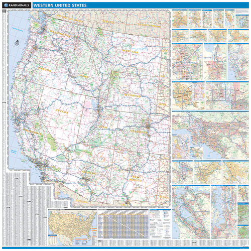
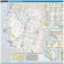
PROSERIES WALL MAP: WESTERN UNITED STATES (R)
DESCRIPTION
Rand McNally's ProSeries wall map of the Western United States is ideal for anyone needing a comprehensive representation of the region for planning, routing, or reference. It's a great choice for business and sales strategy, urban development, social work outreach, education, and marketing. Copyright 2014
Durable (3 mm thick) lamination for writing on and wiping off
Easy-to-read map with clear city and highway detail
UV-resistant ink to help prevent color fading
Mileage chart and driving times map between main cities
Hanging kit with rails for easy mounting just about anywhere
Ideal for business, education, planning, or reference planning
Map indications include:
Interstates, federal highways, and state highways
Cities and towns
Major waterways, rivers, and lakes
State and national parks
National forests and monuments
Universities
Military installations
Airports
Major geographic features
COVERAGE AREA
Coverage area: Arizona, California, Idaho, Montana, Nevada, New Mexico, Oregon, Utah, Washington, Wyoming, and parts of Colorado, Nebraska, North Dakota, Oklahoma, South Dakota, and Texas.
City maps: Albuquerque, NM; Bakersfield, CA: Boise, ID: Colorado Springs, CO; Denver, CO; Fresno, CA; Las Vegas, NV; Los Angeles, CA; Ogden, UT; Phoenix, AZ; Portland, OR; Provo, UT; Sacramento, CA; Salt Lake City, UT; San Diego, CA; San Franciso Bay Area, CA; Seattle/Tacoma, WA; Spokane, WA; Stockton, CA; Tucson, AZ; Lake Tahoe, CA/NV; Napa Valley, CA; Yellowstone National Park, WY; Yosemite National Park, CA
PRODUCT DETAILS
Dimensions: 60" x 60"
Scale: 1" = 30 miles
|
Why are we showing these items?
Search Results
Map, transportation"map" Category "Transportation"
|


-
Refine your browsing experience
We can show you more items that are exactly like the original item, or we can show you items that are similar in spirit. By default we show you a mix.
This item has been added to your cart
 PROSERIES WALL MAP: WESTERN UNITED STATES (R) added to cart.
Only one available in stock
PROSERIES WALL MAP: WESTERN UNITED STATES (R) added to cart.
Only one available in stock
View Cart or continue shopping.
 Please wait while we finish adding this item to your cart.
Get an item reminder
We'll email you a link to your item now and follow up with a single reminder (if you'd like one). That's it! No spam, no hassle.
Already have an account?
Log in and add this item to your wish list.