1882 Aurora Illinois Map - History Map of Aurora Illinois Wall Art Poster Print
Shipping options
Seller handling time is 2 business days Details
This reflects the seller's handling time and may not include time spent in transit.
If you have questions about shipping, please contact the seller.
FREE in United States
Return policy
Full refund available for DOAs
Details
- We guarantee our products and offer full refunds or exchange for defective items or items not as-described.
- Buyer must contact us within 30 days after receipt of shipment.
- The item must be received in the same condition as shipped.
- Items must be returned with all original packaging and accessories.
- Items must not be abused, modified or damaged by accident.
- A 20% restocking fee will be charged for returns
- Buyer is responsible for all return shipping and handling fees.
- Restocking and return shipping fees do not apply when item is returned as defective or because incorrect product was delivered.
Payment options
PayPal accepted
PayPal Credit accepted
Venmo accepted
PayPal, MasterCard, Visa, Discover, and American Express accepted
Maestro accepted
Amazon Pay accepted
Nuvei accepted
Item traits
| Category: |
Art Prints
|
| Quantity Available: |
16 in stock
|
| Condition: |
New
|
| Subject: |
Maps
|
| Style: |
Vintage
|
| Type: |
Wall Art
|
| Features: |
Museum Quality
|
| Theme: |
Vintage
|
| Artist: |
Various
|
| Region of Origin: |
Made in the USA
|
| Brand: |
HISTORIX
|
| Sizes: |
View details
18x24 Inch (8 in stock)
24x36 Inch (8 in stock)
|
Listing details
|
Seller policies:
|
View seller policies
|
|
Shipping discount:
|
Seller pays shipping for this item.
|
|
Posted for sale:
|
More than a week ago
|
|
Item number:
|
1738797520
|
Feature Points
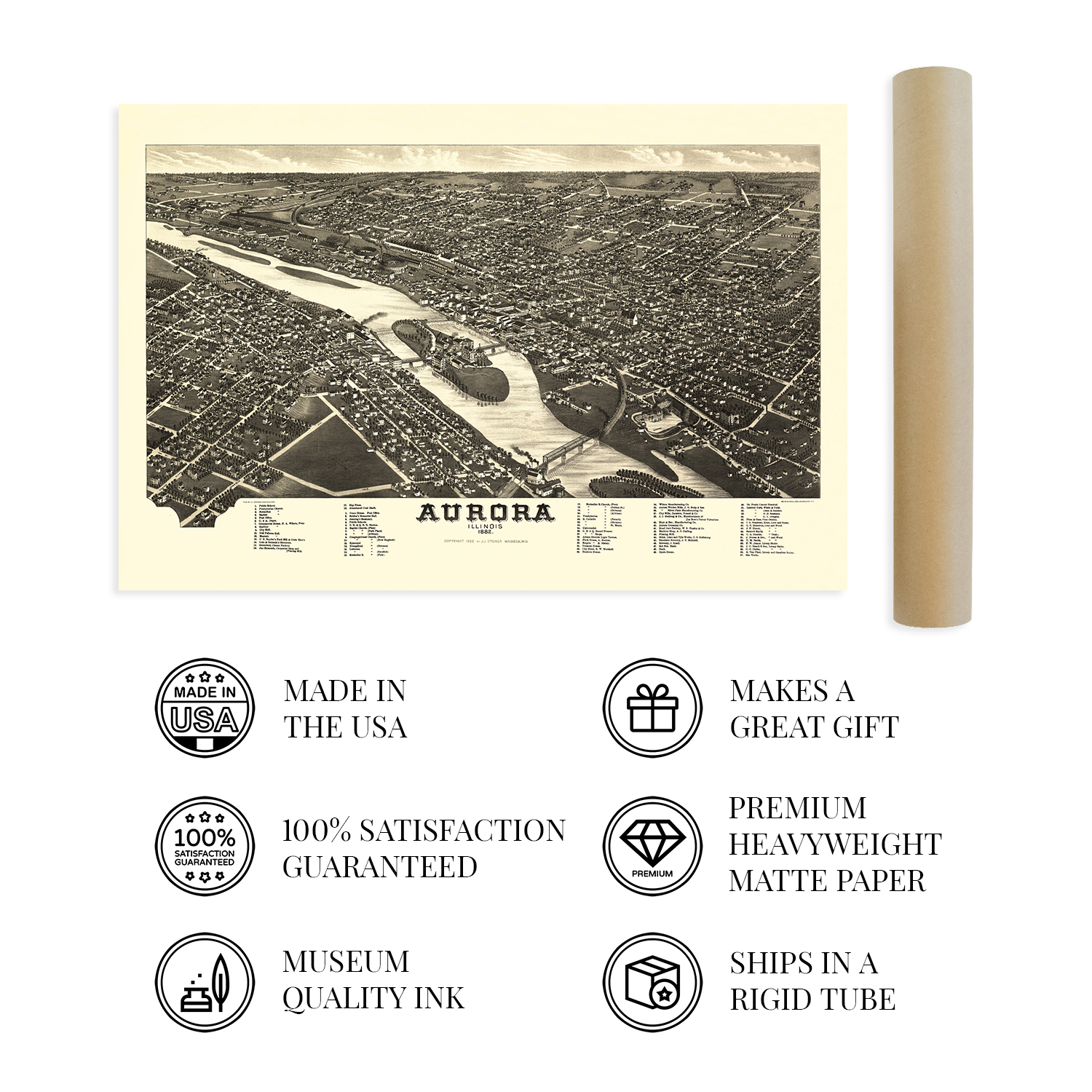
VINTAGE MAP REPRODUCTION: You?ll love this high quality historic reproduction of 1882 Aurora Illinois Map Poster. Our museum quality prints are archival grade, which means it will look great and last without fading for over 100 years. Our print to order maps are made in the USA and each map is inspected for quality. This beautiful artwork is a perfect addition to your themed decor. Vintage maps look great in the home, study or office. They make a perfect gift as well.
MUSEUM QUALITY: This high quality map print will be a great addition to your vintage-themed wall. Don't waste money on cheap-looking, thin paper posters. We use thick, fine art print quality matte paper. Our professional?s choice matte paper displays artwork in high detail without glare. The color is vibrant and text is easy to read. When framed, this map looks absolutely stunning.
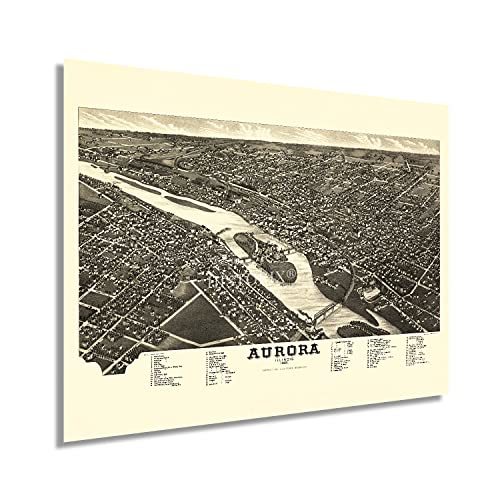
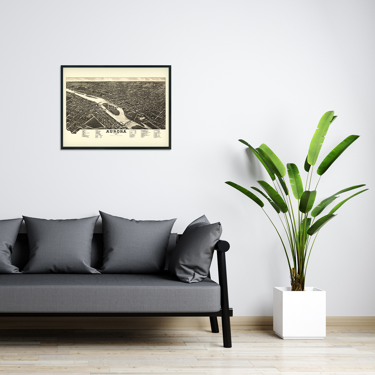
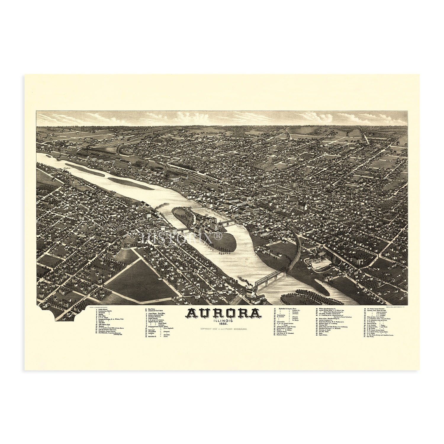
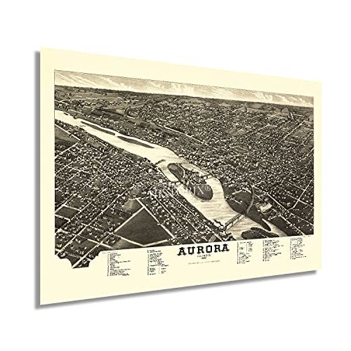
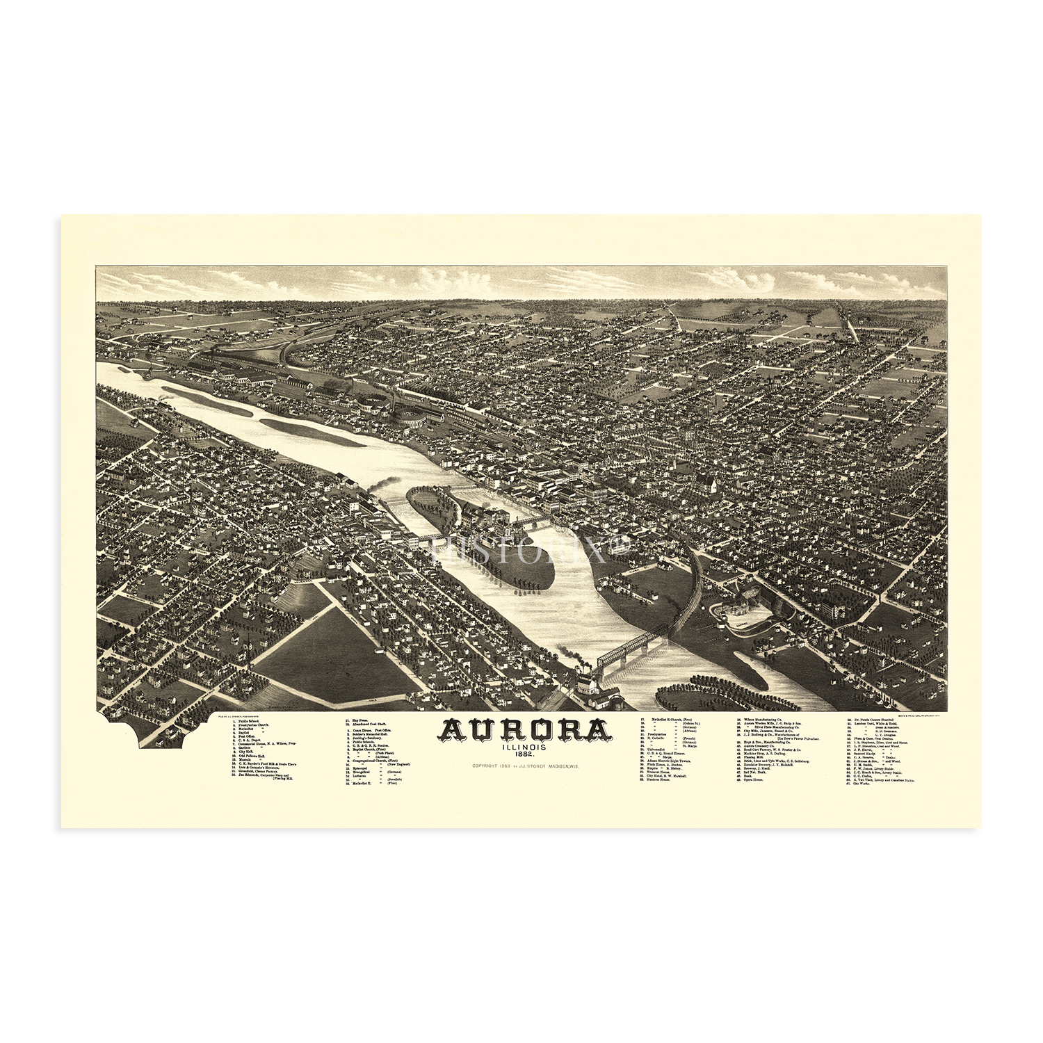
A LOOK BACK AT HISTORY: This is an impressive, historic reproduction of 1882 Aurora Illinois Map. A true piece of history. See our product description section for more fascinating information about this historic map and its significance.
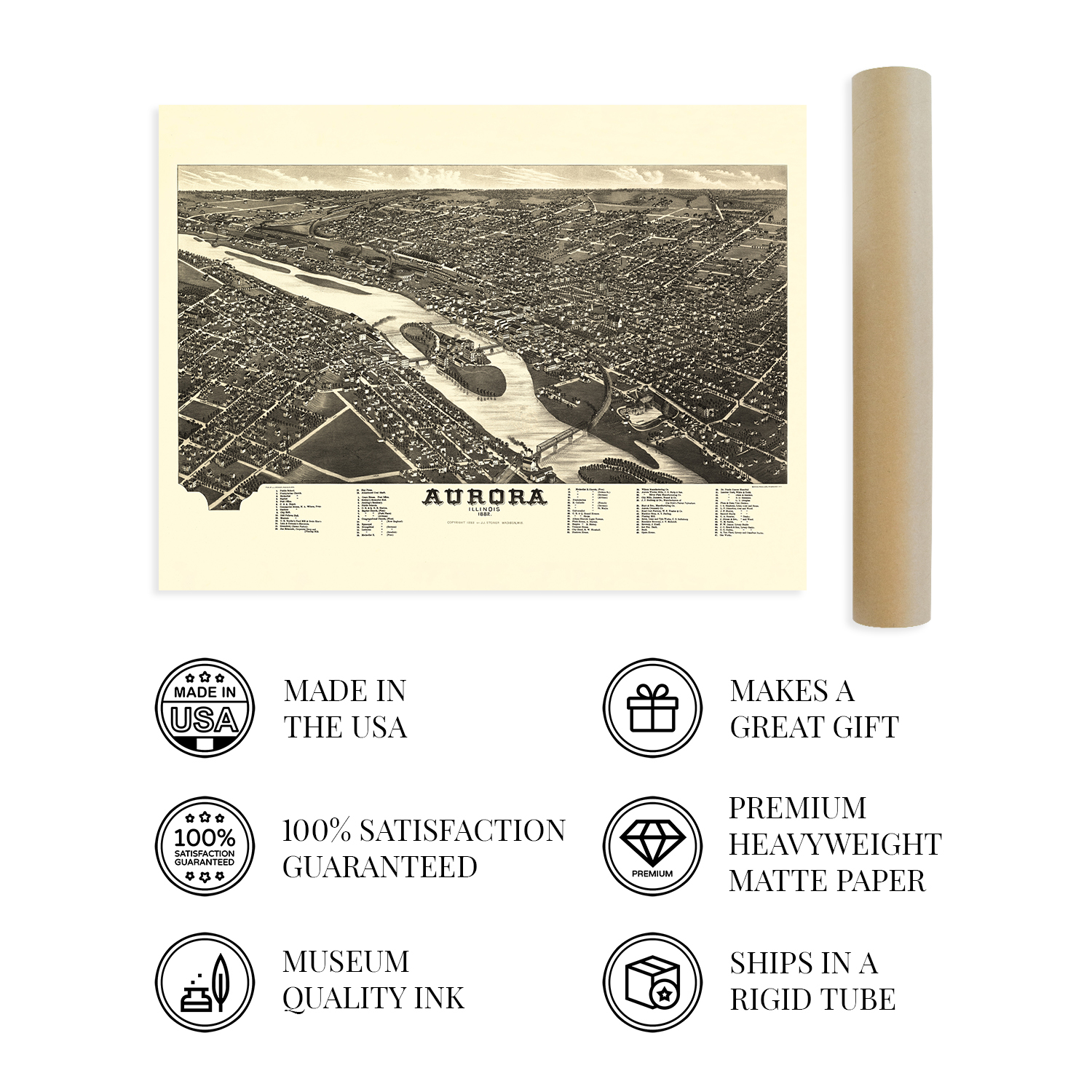
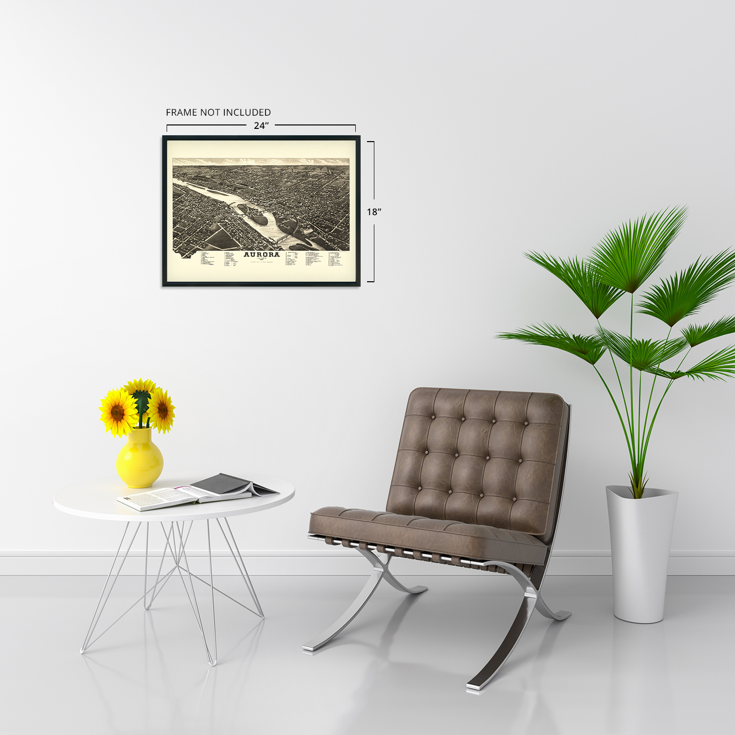
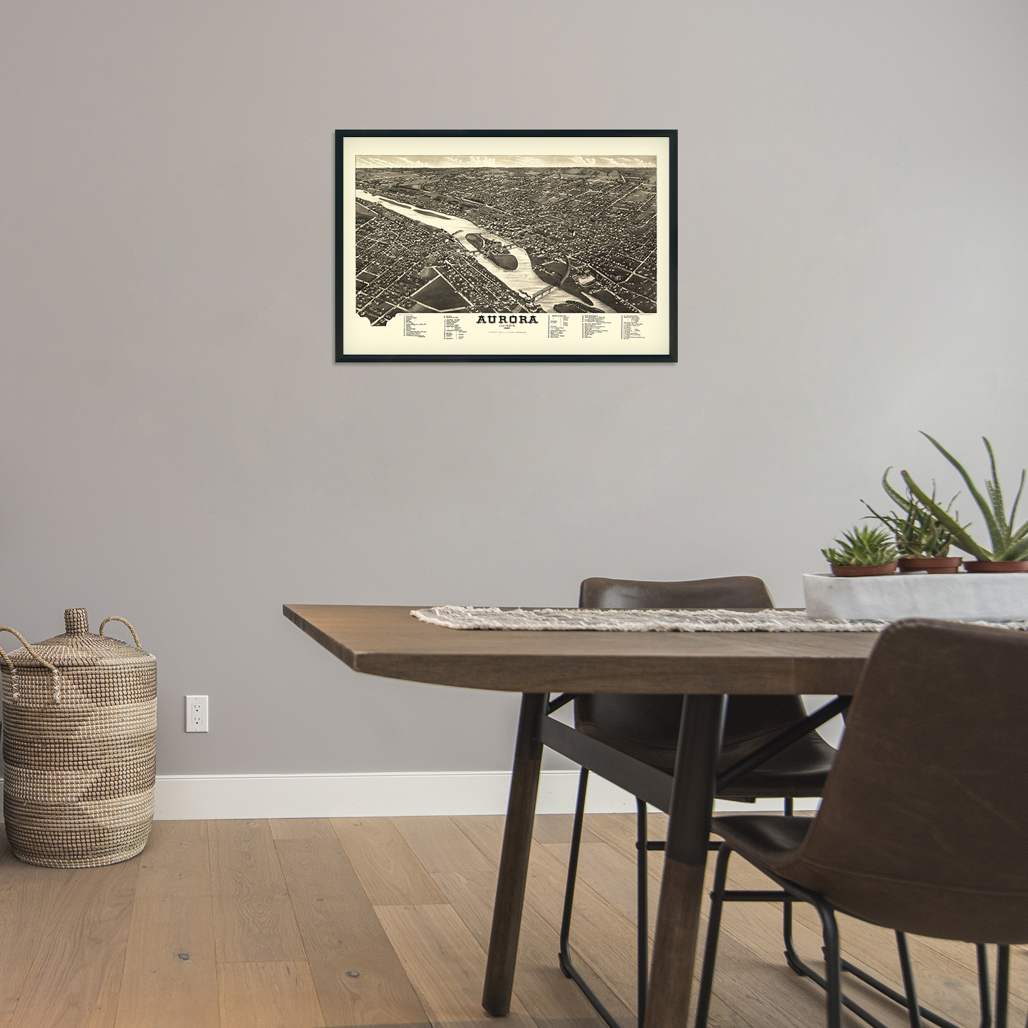
READY TO FRAME: This print includes a 0.2 inch border for a perfect frame fit and look. Our maps are designed to fit easy-to-find standard frame sizes, saving you money from having to pay for a custom frame. Each map is inspected for quality and shipped in a rigid tube.
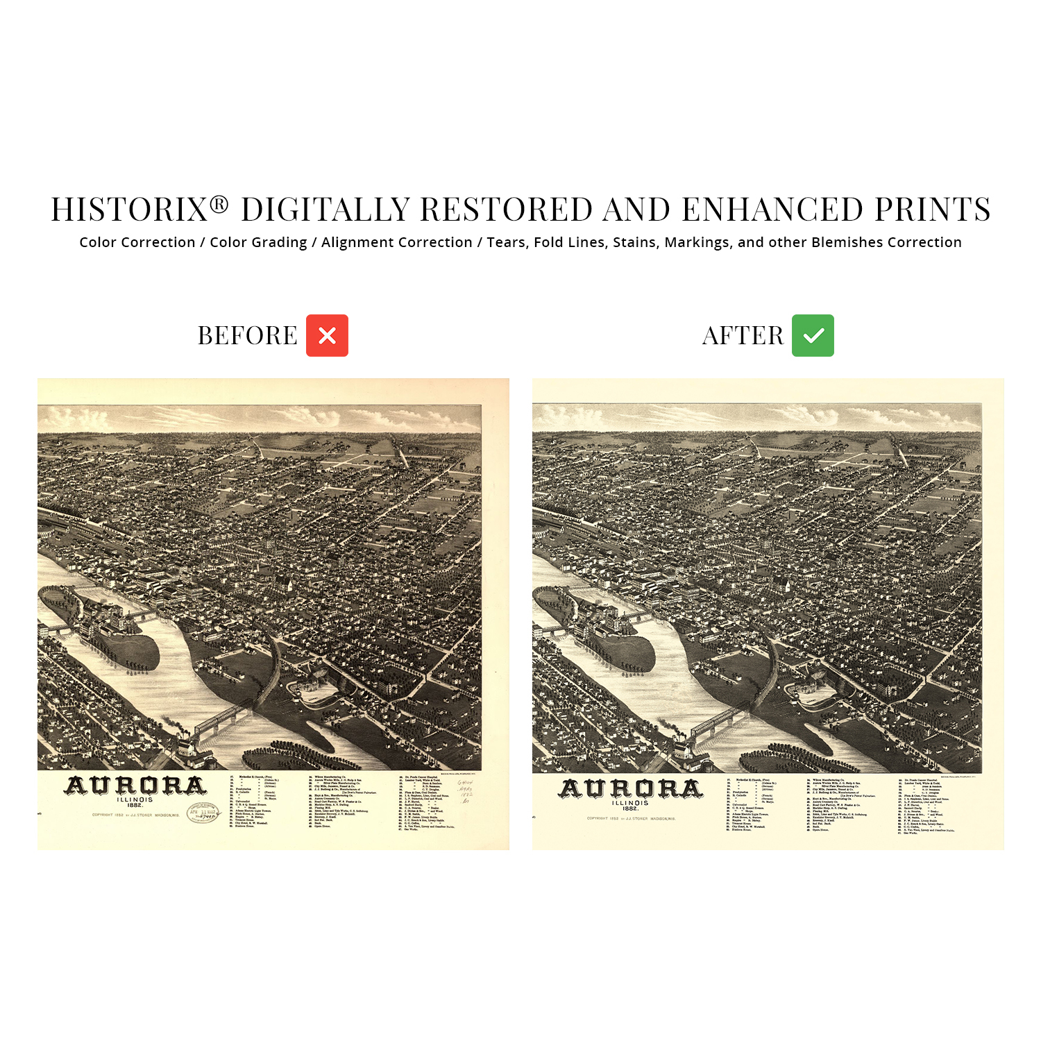
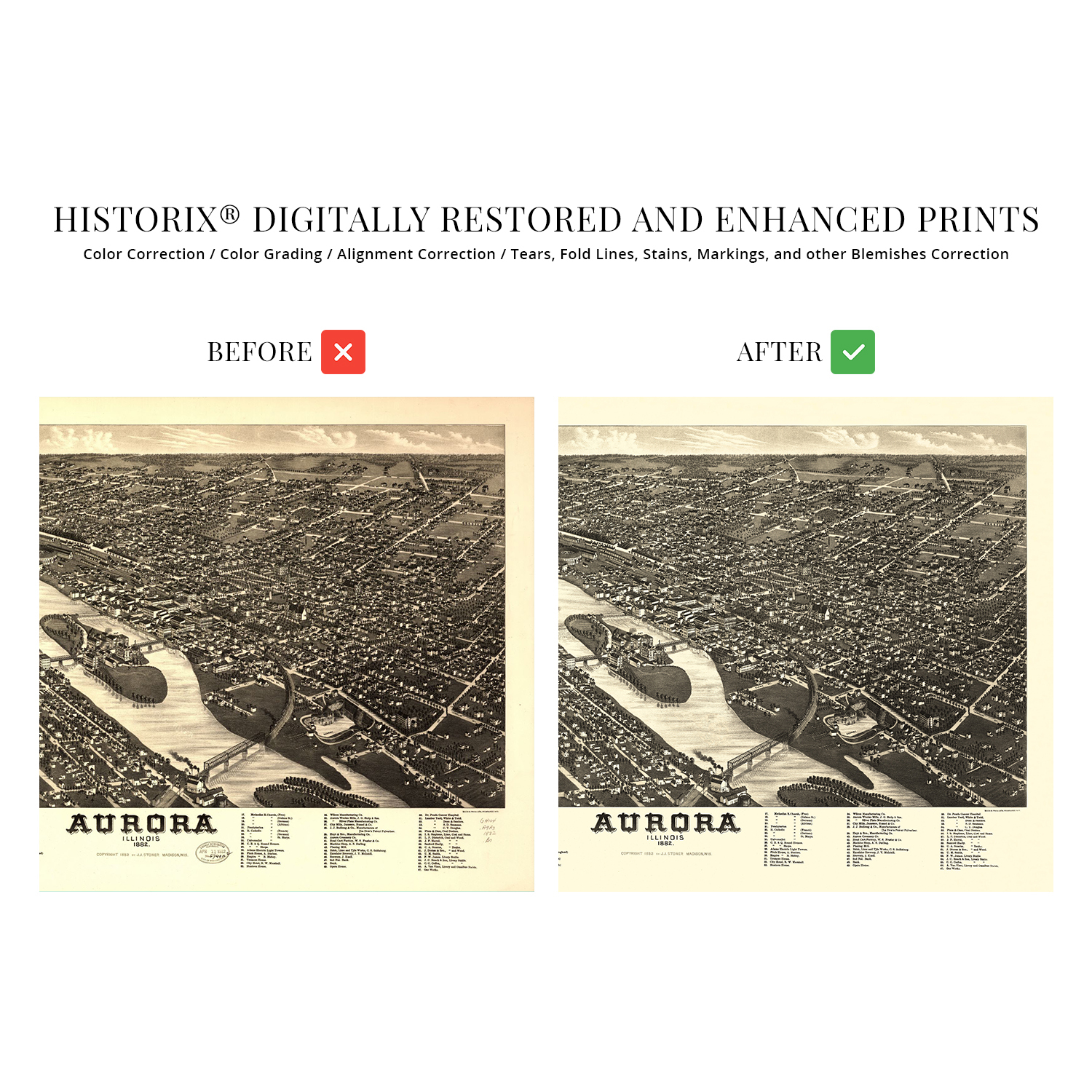
HISTORIX: We love history and art. Sometimes old maps have tears, folds, separations and other blemishes. We digitally restore and enhance maps while keeping its historical character. All our maps are proudly made in the USA. Customers all over the world love our vintage maps and we know you will too.
Additional Information
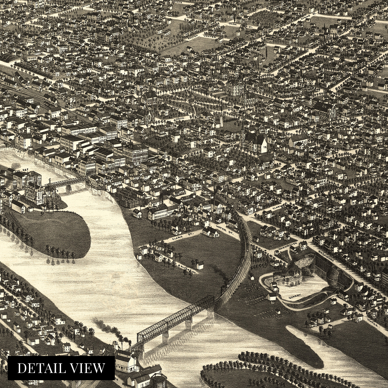
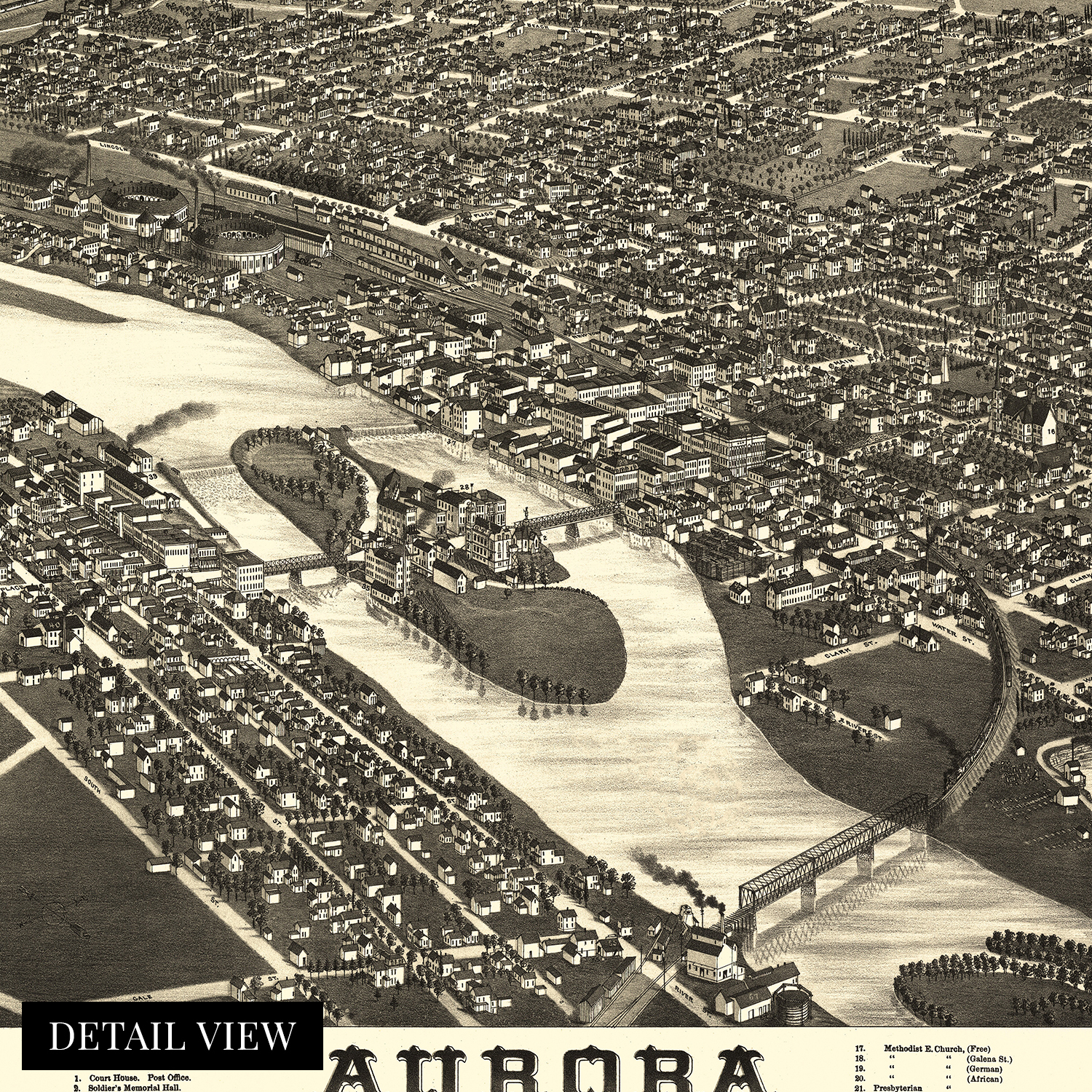
Illustrated by noted American cartographer Herman Brosius, this detailed birds-eye perspective depicts Aurora, Illinois, in significant growth, transformation, and evolution. In the year before this publication, it had been the first American city to implement an all-electric light system. As part of the Chicago metropolitan area, Aurora has grown to become the second-largest city in Illinois. By 1882 the town enjoyed a period of great prosperity spurred on by a thriving manufacturing industry that attracted workers from the American south, Western Europe, and Eastern Europe. These communities established numerous neighborhoods along cultural lines, many of which exist to this day.
During the postwar period, the Chicago metropolitan region grew economically and culturally as railroad expansion had increased access and growth across the nation. The demand for beef to feed Union troops had also increased capacity and production at cattle processing plants throughout the metropolitan area, leading to prosperity across Aurora and Chicago. Aurora was also the home to the Chicago rail line locomotive manufacturing plant, one of the city's largest employers until the 1960s.
Birdseye perspectives were a wildly popular illustration style from the mid-nineteenth century until the 1920s, when advances in flight made aerial photography possible. Their distinctive aesthetic and unique style immediately transport the viewer back in time, creating an indelible bond between the past and present. Bromius' bird's eye perspectives are among the most authentic pieces of American cartographical history, and he himself is one of the most respected mapmakers of the nineteenth century.
Our museum quality giclee print comes printed with archival ink on premium heavyweight matte paper. This eye-catching vintage map reproduction print makes the perfect gift for anyone that loves history and imagery.