HISTORIX Vintage 1855 Florida Map Poster - 18x24 Inch Vintage Florida Map Wall A
Shipping options
Seller handling time is 2 business days Details
This reflects the seller's handling time and may not include time spent in transit.
If you have questions about shipping, please contact the seller.
FREE via to United States
Return policy
Full refund available for DOAs
Details
- We guarantee our products and offer full refunds or exchange for defective items or items not as-described.
- Buyer must contact us within 30 days after receipt of shipment.
- The item must be received in the same condition as shipped.
- Items must be returned with all original packaging and accessories.
- Items must not be abused, modified or damaged by accident.
- A 20% restocking fee will be charged for returns
- Buyer is responsible for all return shipping and handling fees.
- Restocking and return shipping fees do not apply when item is returned as defective or because incorrect product was delivered.
Payment options
PayPal accepted
PayPal Credit accepted
Venmo accepted
PayPal, MasterCard, Visa, Discover, and American Express accepted
Maestro accepted
Amazon Pay accepted
Nuvei accepted
Item traits
| Category: |
Kitchen Scales
|
| Quantity Available: |
8 in stock
|
| Condition: |
New
|
| UPC: |
705514893772
|
| MPN: |
ENMAP07051824
|
| Style: |
Vintage/Retro
|
| EAN: |
0705514893772
|
| Bullet Point: |
View details
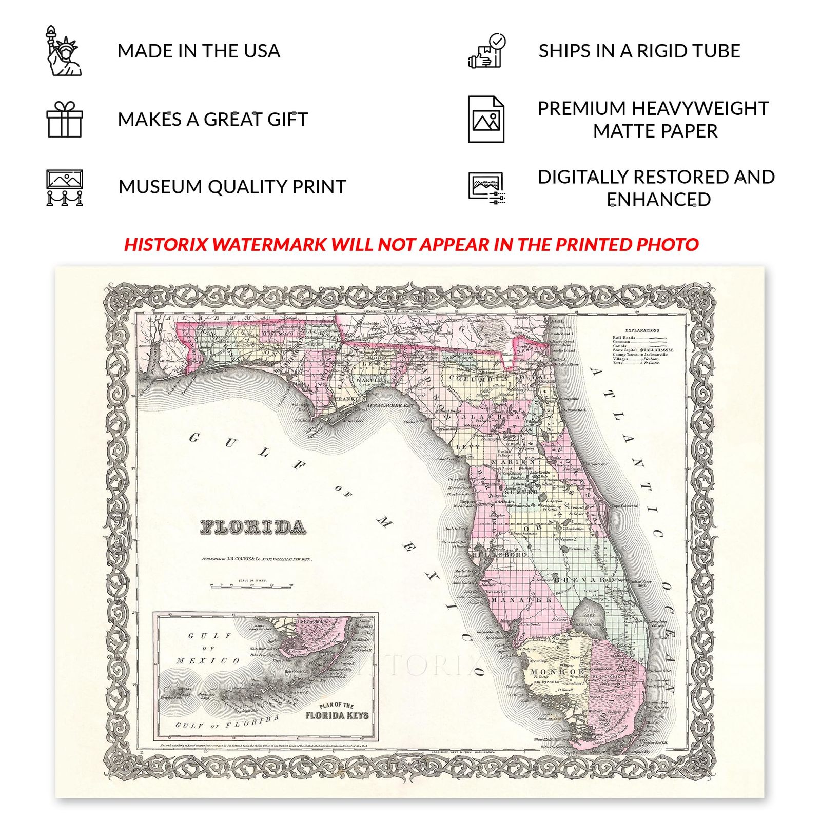
VINTAGE MAP REPRODUCTION: You’ll love this high quality historic reproduction of 1855 Florida State Map Poster. Our museum quality prints are archival grade, which means it will look great and last without fading for over 100 years. Our print to o...
|
| Product Description: |
View details
Produced with a distinguished style and unique aesthetic, this map of Florida was created by GW Colton and featured in his Atlas of the World, Illustrating Physical and Political Geography, in 1855. It remains a classic publication of one of th...
|
| Brand: |
HISTORIX
|
| Unspsc Code: |
55101500
|
| Externally Assigned Product Identifier: |
705514893772
|
| Item Type Keyword: |
prints
|
| size: |
24L" x 18W"
|
| Part Number: |
ENMAP07051824
|
| Wall Art Form: |
poster
|
| Target Gender: |
unisex
|
| Paint Type: |
Watercolor
|
| Color: |
Natural
|
| Pattern: |
Printed
|
| manufacturer: |
HISTORIX
|
| Item Shape: |
Rectangular
|
| theme: |
Map
|
| orientation: |
Landscape
|
| Item Name: |
View details
HISTORIX Vintage 1855 Florida Map Poster - 18x24 Inch Vintage Florida Map Wall Art Print - History Map of Florida Poster - Old Map of Florida Wall Art
|
| Material: |
Paper
|
| Mounting Type: |
Wall Mount
|
Listing details
|
Seller policies:
|
View seller policies
|
|
Shipping discount:
|
Seller pays shipping for this item.
|
|
Posted for sale:
|
More than a week ago
|
|
Item number:
|
1735173854
|
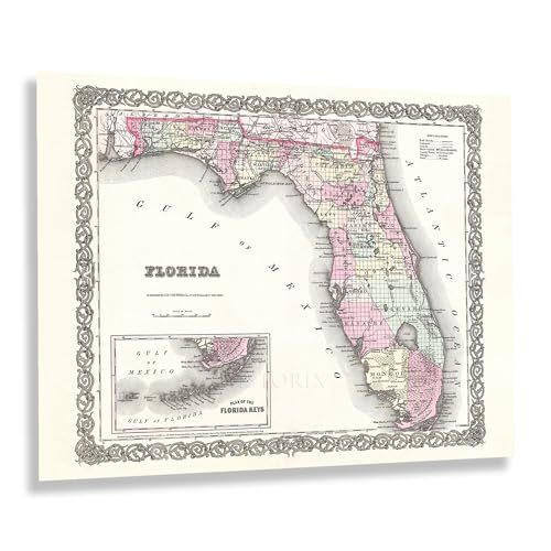
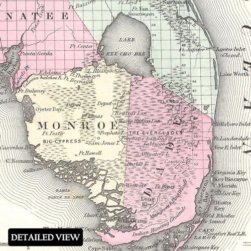
Produced with a distinguished style and unique aesthetic, this map of Florida was created by GW Colton and featured in his Atlas of the World, Illustrating Physical and Political Geography, in 1855. It remains a classic publication of one of the most iconic states of the American South, with a rich history and distinctive blend of Caribbean, European, and American influences. Since Columbus' first expeditions to North America, the region that would become Florida came under Spanish control, and these influences remain an integral part of the state's culture. Colton used previously produced maps to create this map of the state in a period of significant transformation as the nation neared one of the most critical moments in American History as the Civil War loomed.
This map was made only one decade after Florida became the 27th state in the contiguous United States. The region slowly grew during the nineteenth century before a population boom in the twentieth century occurred, spurred by destinations created in Miami and Key West, which attracted scores of sports fishermen eager to discover vast swaths of natural habitats. The region also experienced many visitors en route to destinations in the Caribbean, including Cuba and Puerto Rico, the British Virgin Islands, and the French Islands, including Martinique.
This map, a piece of American cartographical history, immediately transports the viewer back in time, creating an indelible link between the past and present. It is a tangible representation of the historical and cultural influences that have shaped one of the most iconic American states, Florida.
Additional Details
------------------------------
Bullet point: VINTAGE MAP REPRODUCTION: You?ll love this high quality historic reproduction of 1855 Florida State Map Poster. Our museum quality prints are archival grade, which means it will look great and last without fading for over 100 years. Our print to order maps are made in the USA and each map is inspected for quality. This beautiful artwork is a perfect addition to your themed decor. Vintage maps look great in the home, study or office. They make a perfect gift as well.
Product description:
Produced with a distinguished style and unique aesthetic, this map of Florida was created by GW Colton and featured in his Atlas of the World, Illustrating Physical and Political Geography, in 1855. It remains a classic publication of one of the most iconic states of the American South, with a rich history and distinctive blend of Caribbean, European, and American influences. Since Columbus' first expeditions to North America, the region that would become Florida came under Spanish control, and these influences remain an integral part of the state's culture. Colton used previously produced maps to create this map of the state in a period of significant transformation as the nation neared one of the most critical moments in American History as the Civil War loomed.
This map was made only one decade after Florida became the 27th state in the contiguous United States. The region slowly grew during the nineteenth century before a population boom in the twentieth century occurred, spurred by destinations created in Miami and Key West, which attracted scores of sports fishermen eager to discover vast swaths of natural habitats. The region also experienced many visitors en route to destinations in the Caribbean, including Cuba and Puerto Rico, the British Virgin Islands, and the French Islands, including Martinique.
This map, a piece of American cartographical history, immediately transports the viewer back in time, creating an indelible link between the past and present. It is a tangible representation of the historical and cultural influences that have shaped one of the most iconic American states, Florida.
Style: Retro