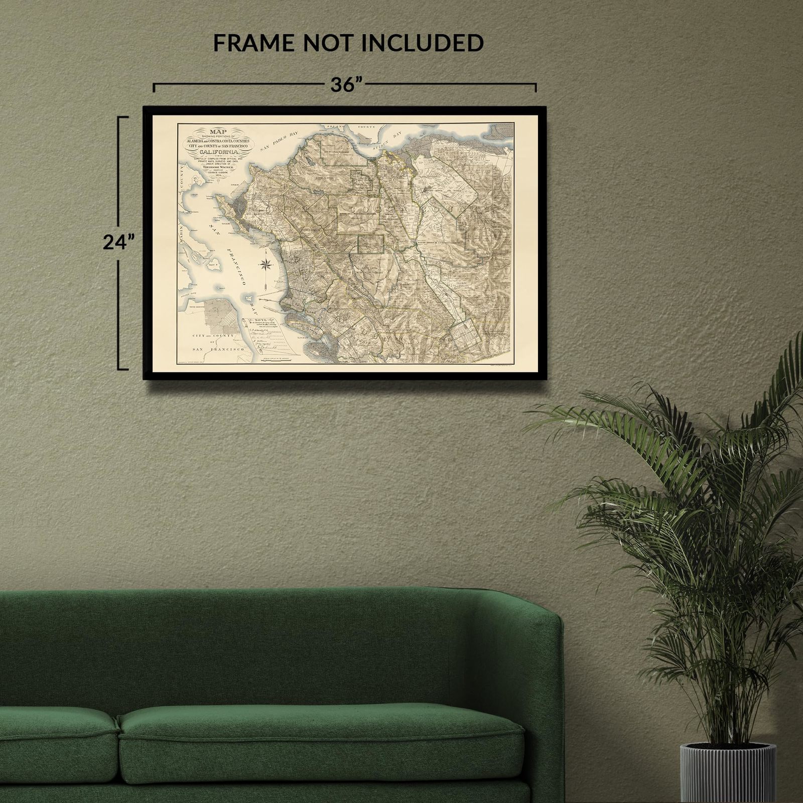
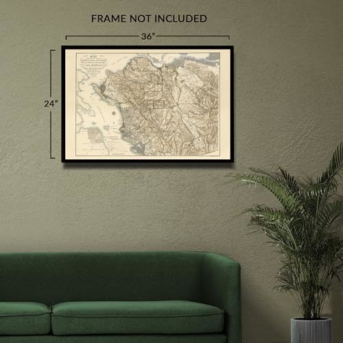
HISTORIX Vintage 1894 Alameda & Contra Costa Map Print - 24x36 Inch Old Map of A
Shipping options
Seller handling time is 2 business days Details
This reflects the seller's handling time and may not include time spent in transit.
If you have questions about shipping, please contact the seller.
FREE via to United States
Return policy
Full refund available for DOAs
Details
- We guarantee our products and offer full refunds or exchange for defective items or items not as-described.
- Buyer must contact us within 30 days after receipt of shipment.
- The item must be received in the same condition as shipped.
- Items must be returned with all original packaging and accessories.
- Items must not be abused, modified or damaged by accident.
- A 20% restocking fee will be charged for returns
- Buyer is responsible for all return shipping and handling fees.
- Restocking and return shipping fees do not apply when item is returned as defective or because incorrect product was delivered.
Payment options
PayPal accepted
PayPal Credit accepted
Venmo accepted
PayPal, MasterCard, Visa, Discover, and American Express accepted
Maestro accepted
Amazon Pay accepted
Nuvei accepted
Item traits
| Category: |
Laminating Machines
|
| Quantity Available: |
8 in stock
|
| Condition: |
New
|
| MPN: |
ENMAP06922436
|
| UPC: |
705514892133
|
| EAN: |
0705514892133
|
| Paint Type: |
Watercolor
|
| color: |
Natural
|
| manufacturer: |
HISTORIX
|
| Externally Assigned Product Identifier: |
0705514892133
|
| Item Shape: |
Rectangular
|
| Bullet Point: |
View details
VINTAGE MAP REPRODUCTION: You’ll love this high quality historic reproduction of 1894 Alameda & Contra Costa Map Print. Our museum quality prints are archival grade, which means it will look great and last without fading for over 100 years. Our pr...
|
| Product Description: |
View details
Alameda and Contra Costa Counties have been essential areas in California's Northern Coast for centuries as the regions developed with bustling ports. This map was produced in a period of significant growth and prosperity, which the region had ...
|
| Brand: |
HISTORIX
|
| Unspsc Code: |
55101500
|
| orientation: |
Landscape
|
| Paper Finish: |
matte
|
| Item Name: |
View details
HISTORIX Vintage 1894 Alameda & Contra Costa Map Print - 24x36 Inch Old Map of Alameda & Contra Costa County San Francisco California Wall Art Poster
|
| Item Type Keyword: |
wall-maps
|
| size: |
36L" x 24W"
|
| Mounting Type: |
Wall Mount
|
| Part Number: |
ENMAP06922436
|
| style: |
Classic
|
| Wall Art Form: |
poster
|
| Room Type: |
Office
|
| Target Gender: |
unisex
|
Listing details
|
Seller policies:
|
View seller policies
|
|
Shipping discount:
|
Seller pays shipping for this item.
|
|
Posted for sale:
|
More than a week ago
|
|
Item number:
|
1735828327
|
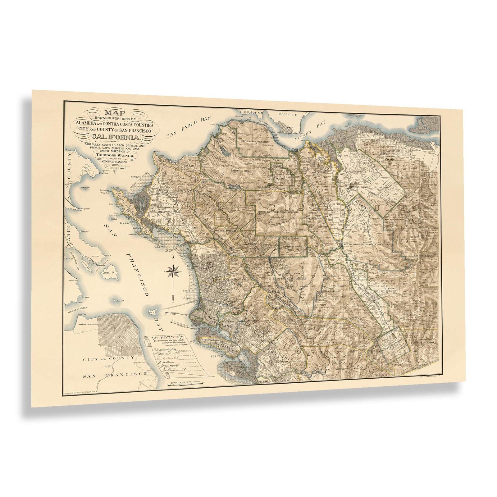
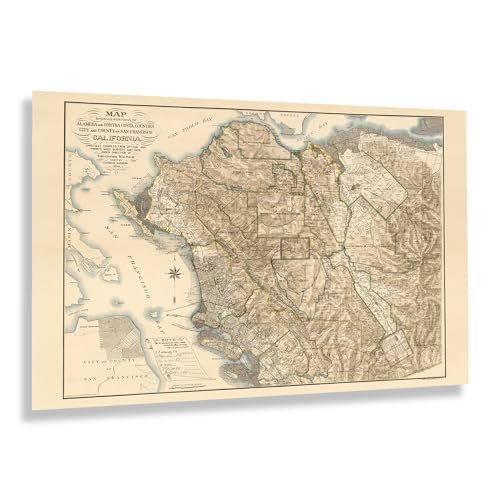
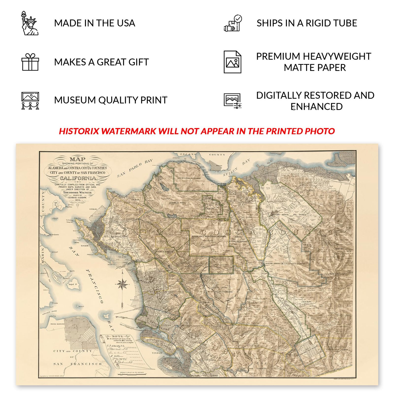
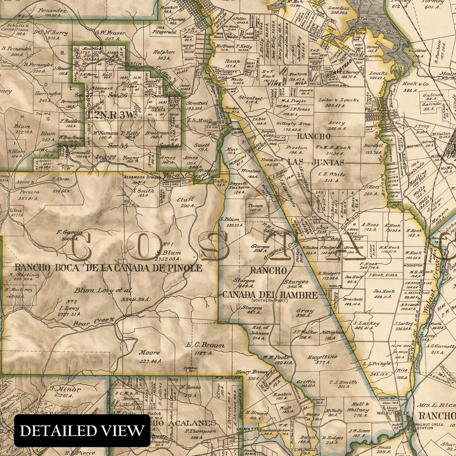
Alameda and Contra Costa Counties have been essential areas in California's Northern Coast for centuries as the regions developed with bustling ports. This map was produced in a period of significant growth and prosperity, which the region had enjoyed since the middle of the nineteenth century when vast gold reserves were discovered in the Sierra Nevada Mountains, bringing considerable wealth to the cities as a banking hub on the West Coast. During the nineteenth century, San Francisco rivaled Los Angeles, Seattle, and Portland, Oregon, as a trading port for goods being imported to the United States from Asia and exporting American-made goods to foreign markets.
As the nation approached the turn of the century, the Bay Area, along with the rest of the country, was being transformed in the years of the Industrial Revolution and a period of peace following the conclusion of the American Civil War in addition to technological advances in transportation, architecture, and culture as America became one of the most influential nations in the world and continued to develop. This map was produced by the prolific San Francisco-based lithography firm Britton Rey, who created numerous works during the nineteenth century.
This map's distinctive style and classic aesthetic immediately transport the viewer back in time, creating a lasting bond between the past and present that illustrates the evolution and growth of the region through the following centuries. This is an authentic piece of cartographical history.
Additional Details
------------------------------
Bullet point: VINTAGE MAP REPRODUCTION: You?ll love this high quality historic reproduction of 1894 Alameda Contra Costa Map Print. Our museum quality prints are archival grade, which means it will look great and last without fading for over 100 years. Our print to order maps are made in the USA and each map is inspected for quality. This beautiful artwork is a perfect addition to your themed decor. Vintage maps look great in the home, study or office. They make a perfect gift as well.
Product description:
Alameda and Contra Costa Counties have been essential areas in California's Northern Coast for centuries as the regions developed with bustling ports. This map was produced in a period of significant growth and prosperity, which the region had enjoyed since the middle of the nineteenth century when vast gold reserves were discovered in the Sierra Nevada Mountains, bringing considerable wealth to the cities as a banking hub on the West Coast. During the nineteenth century, San Francisco rivaled Los Angeles, Seattle, and Portland, Oregon, as a trading port for goods being imported to the United States from Asia and exporting American-made goods to foreign markets.
As the nation approached the turn of the century, the Bay Area, along with the rest of the country, was being transformed in the years of the Industrial Revolution and a period of peace following the conclusion of the American Civil War in addition to technological advances in transportation, architecture, and culture as America became one of the most influential nations in the world and continued to develop. This map was produced by the prolific San Francisco-based lithography firm Britton Rey, who created numerous works during the nineteenth century.
This map's distinctive style and classic aesthetic immediately transport the viewer back in time, creating a lasting bond between the past and present that illustrates the evolution and growth of the region through the following centuries. This is an authentic piece of cartographical history.